
This trip we where lucky enough to be able to camp at a shack in Linda to avoid the chaos of the long weekend so we could go and check out the Kelly Basin and surrounding area’s.
Mt McCall Track.
After arriving on Friday night setting up and enjoying a few beers we where keen to get out and start exploring so we were up at the crack of dawn on Saturday and ready to go.  We were slightly concerned with the weather as it was supposed to be a brilliant day but it was foggy and cold, Queenstown was covered with a blanket of fog.
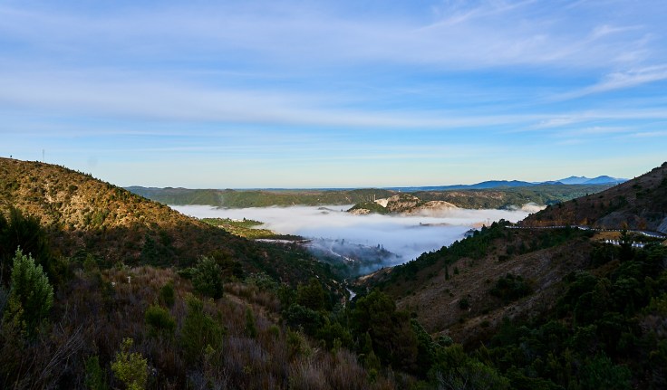
This was a little worrying as we knew there where some spectacular views in store for the day that may be missed but there was way to much organising that went on behind the scene from Heidi and Dirk to get a key from Parks and Wildlife to get access to the Mt McCall track to put it off any longer, So we met with Parks in Queenstown got our vehicles Quarantined and we were off. First stop was the gate. Whilst Dirk tried to unlock this near impossible gate the rest of us stood around took photo’s and laughed and it wasn’t until we thought we may not get in that we all jumped in to give him a hand. After negotiating the near impossible gate we continued on the track until we came across the site that Bob Brown was born.
  From here we continued on and the track went from a well-formed forestry rd that I’m guessing is maintained by the beekeepers to a slightly tighter and worn track that wound itself around Mt McCall and down towards the Dam site. The views we got on the way where incredible, you could see from Lake Burbury to Macquarie Harbour and even just make out some of the fish farms.

After getting to the car park we thought it would be silly not to walk down to the Franklin River after coming so far and at this stage we where all pretty happy about it. 
The track started pretty steep following an old pipe line down a hill which wasn’t to bad until we came across the pegs and chain.
At the time we thought this might of only been for a short section but it lasted for a majority of the way down and where there wasn’t chain it was ladders disguised as stairs. The walking track is 530m long and drops nearly 280m to give an idea of how steep it is. Although this was Tourcher there were some good views along the way  of Propsting Gorge and you can even still see the standing scaffold of when they were starting the dam site.
This was pretty interesting as it gives an idea of how they ran the pipeline and the tram-line down this incredibly steep hill to from what I can gather start building.
Just before the knees where about to collapse we thankfully made it to the bottom and it was well worth the effort as the views were pretty good. 

After dying and coming back to life a few times climbing back up the hill we had some lunch at the picnic area and then started the climb back out in the busses. Although the bottom of the track is pretty steep it isn’t much of a challenge in the dry so there weren’t many dramas on the way out.
Mt Huxley Track.
From here we decided to go and tackle the Mt Huxley track as it is rated hard on the Parks and wildlife site. Unless you have printed out directions or marked it on a GPS it is hard to follow as there are tracks going of in every direction. Like the Mt McCall track its hardness was slightly overrated this track although very steep in some areas would be classed as a medium in the dry but in the wet may be a different story. Once again though like everywhere in this area the views were great and it was well worth the drive.  I didn’t capture this image as well as I hoped as it was taken directly into the sun but the view of the west coast from here was spectacular you could see from Heemskirk Ranges right down past Hells Gates. We later found out that there was a walk to the summit of Mt Huxley and I imagine the views from there would be even better again.
After a massive day exploring we headed back to camp and then to the pub for a much-needed beer and meal.
Pillinger.
The next morning we where up early once again to go and check out the Kelly Basin (Pillinger) which is now a ghost town but once serviced up to 1000 people and was the only route to Queenstown for the Ore to be transferred from mines to ship. Unfortunately though the start of the track is closed because of an apparent landslide  now I’m not sure if landslides have evolved to be invisible but that looks like a perfectly safe track to me but anyway there wasn’t much we could do about it so we just bit the bullet and walked in.
It’s not until you get to the Bird River Bridge (which is where the car park should have been) that the history trail starts. Although the whole track is an old Rail line the relics don’t start until after the bridge and the first thing that you come across is an old wooden tank.
  Water would have been diverted from the creek beside it to keep the tank full and this would of been used to transfer water into the steam engines used to power the locomotive’s. Not much further up from this I heard a little waterfall in the Bird River so went down to investigate
  and whilst I was down there Bradley spotted what we think might have been an old lamp post directly under where I climbed down to the river.
  Great view of the river popped up a fair bit along the river it was a rather spectacular walk.
 I was also keeping a close eye out on some fungi of different sorts as I have heard Queenstown area is a hotspot for it but only found some more common types (So I think anyway)
 Then we thought we found the jackpot and found truffles but quickly realised we were wishful thinking as it wasn’t buried in the ground.
  After getting excited over nothing we kept walking and eventually made it to Pillinger and had a look around
 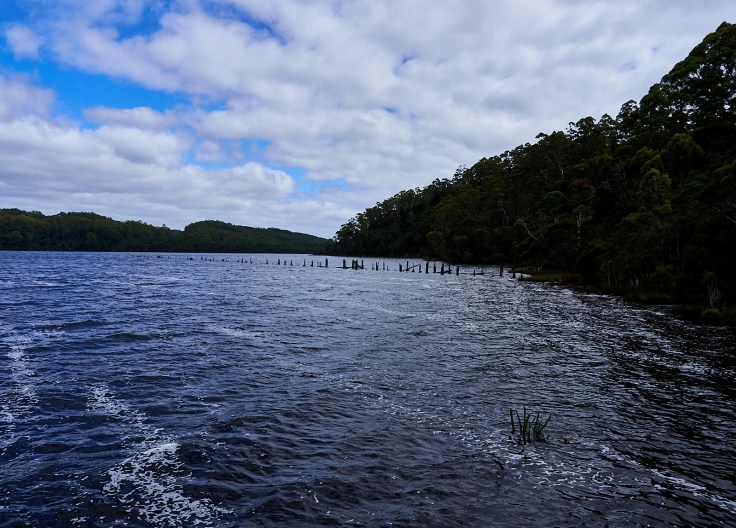 East Pillinger Pier that was once over 200m in length and was able to support rail so the ships could be loaded with ore or unloaded with goods to supply the west coast.
 The old Bakery.
  What’s left of an old luxury train carriage that was imported from England.
  Brick Kilns used to make and dry bricks to service Queenstown and the Surrounding areas.

2 of the 3 boilers that were used. These boilers even in their day where a ticking time-bomb. The poms at the time sent us single riveted boilers when the standard was double riveted to stop or help prevent explosions when or if the boiler was ever let to run dry. Even back in those days the energy these would have created would have been impressive and would have no doubt flattened the surrounding area if it did ever explode. More info on Pillinger here.
As the walk was so far in we didn’t get the chance to have a look at West Pillinger which I have heard is just as impressive so we decided to save it for next time and make our way back out to the vehicles. By the time we got to about a km before the cars I think everyone was about ready to collapse but the thought of the beer in the fridges kept everyone going and we finally made it out after a 23km round trip of walking. From here anything involving walking was out of the question so it was vehicle only and Dirk found out the night before where the old township of Crotty was located so we thought we would go and try our luck but unfortunately there was just a little bit too much water in Lake Burbury to see it. So we went back to the shack and drank some more beer to numb the pain of the legs.
Mt Jukes Mines.
The next morning before we packed and headed for the hills we thought we would do yet another run back towards Lake Burbury and check out the Jukes Propriety Mines located near the lookout and we where quite surprised at what we found these mines where in great condition and very well-preserved.  The mines where Copper mines and started operation in the very early 1900’s (I’m not sure of the exact info as I hadn’t had the chance to research it but info can be found here.)
  unfortunately water fell on the lens when taking this photo but still had to post it up as it was so impressive this shaft was about 30 to 40 m high and still had a ladder about quarter of the way up and the timber was still in fantastic nick.
  Been a copper mine copper sulphate was leaching out of the walls everywhere. At the time not knowing but expecting there to be another Adit up further we decided to climb the hill a bit further and have a look for another Adit and sure enough Bradley found one.
  Unfortunately as we weren’t expecting to be exploring mines this trip none of us brought our gumboots so we decided to save this one for next time but on the left of this photo you can just see the top of the shaft we found in the bottom section of the mine. From here we went and finished packing up and headed for home.
Until Next time Happy Travels
Cheers
Tassietravelsblog.
Full Video here.
Great write up
Cheers thanks for that
Hey Brendan, any chance you’d have some track notes for the Mt Huxley track? I notice your blog says there are tracks everywhere… Thanks! Alex.
Just need to follow the map/ track as best you can to Mt Huxley. It’s hard to explain and I can’t post a pict of the map on here but the track is realitivly easy there are a few steep areas but nothing to extreme. Once you get to the end of it the track keeps going straight but the actual end of it is up the the right
Thanks for the reply! I’ve found it in the 4wd tracks book too, so I think we’ll be fine.
Cool mate. I’m down in Kelly Basin now on a sail boat and about to walk up to the Bird River track. So these photos were great to see.